
Photogrammetry
Modern photogrammetry is a tool that can provide great flexibility to the work of a Rural and Survey Engineer. It greatly reduces the time a surveyor has to spend in the field, it contributes to saving resources and time during a mapping or survey. Moreover, the final products of photogrammetry methods are richer in information than a conventional mapping method. Those products are:
- Orthophotos – Orthophoto maps
- 3D models
- Digital Surface Models (DSM) and Digital Elevation Models (DEM)
- Mapping with the help of stereo models
 |
TOPODOMIKI has multiyear experience and a well–trained staff and has at her disposal the following necessary equipment to be able to make the most out of modern photogrammetry:
- Digital Photogrammetry Stations
- Digital Cameras of high analysis
- Professional photography equipment (lighting, tripods, stands, etc.)
- Drone (UAV)
- All the required topographic equipment for the additional work
Our firm, using the above resources, has offered aerial and surface photogrammetry services to a plethora of private entities.
  |
Indicative Works
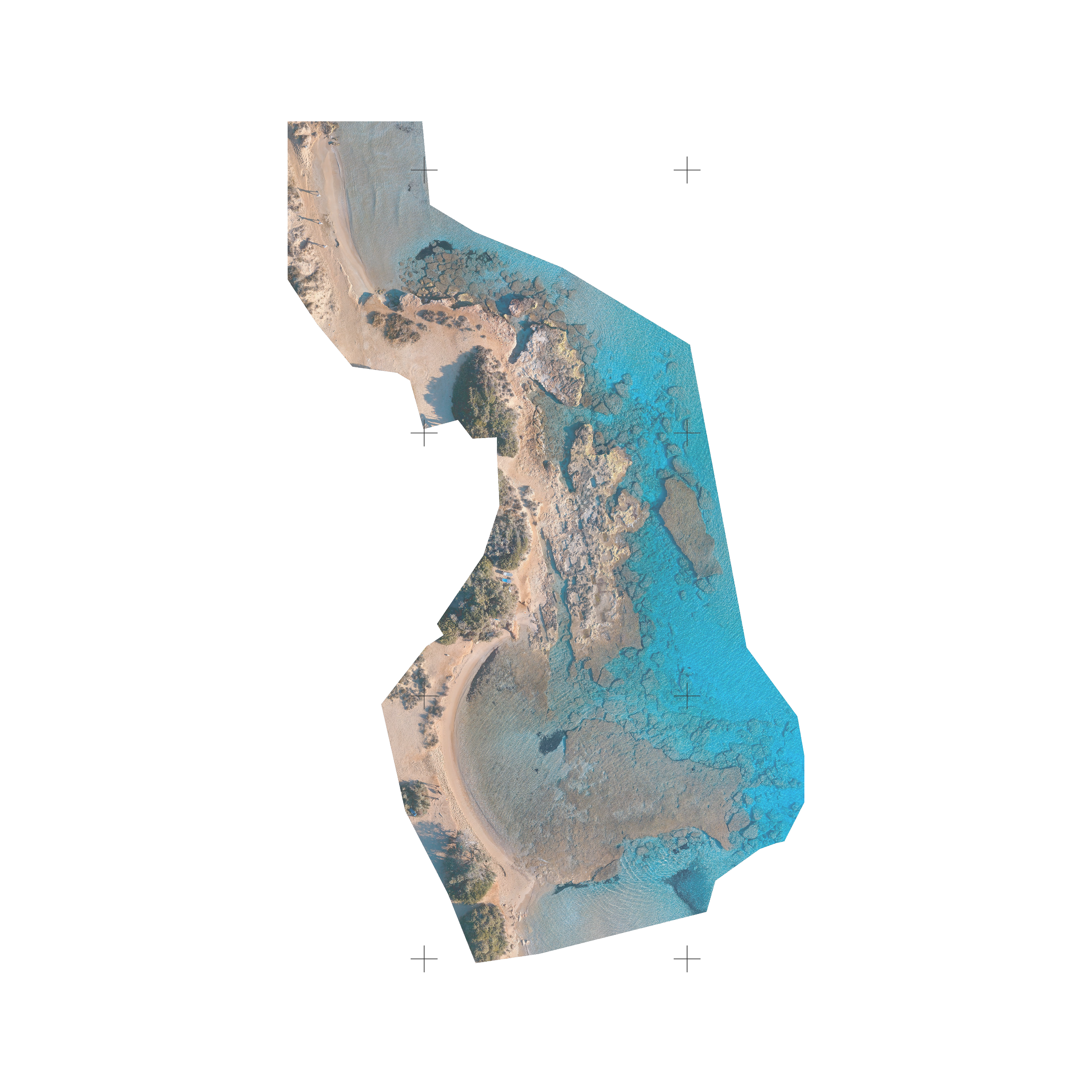
- 3D photogrammetric mapping of marine archeological sites in the islands of Paros, Antiparos, and Despotiko and specifically in the areas of Santa Maria of Paros, the island of Despotiko, and Agios Nikolaos – Voutakos of Paros in which a correction to the water refraction has been applied.
- Complete 3D photogrammetric mapping of a zone for establishing boundaries – arranging watercourses in Thiva, Viotia.
- Complete 3D modeling of the Holy Temple of the Resurrection of Christ in Spata, eastern Attica.
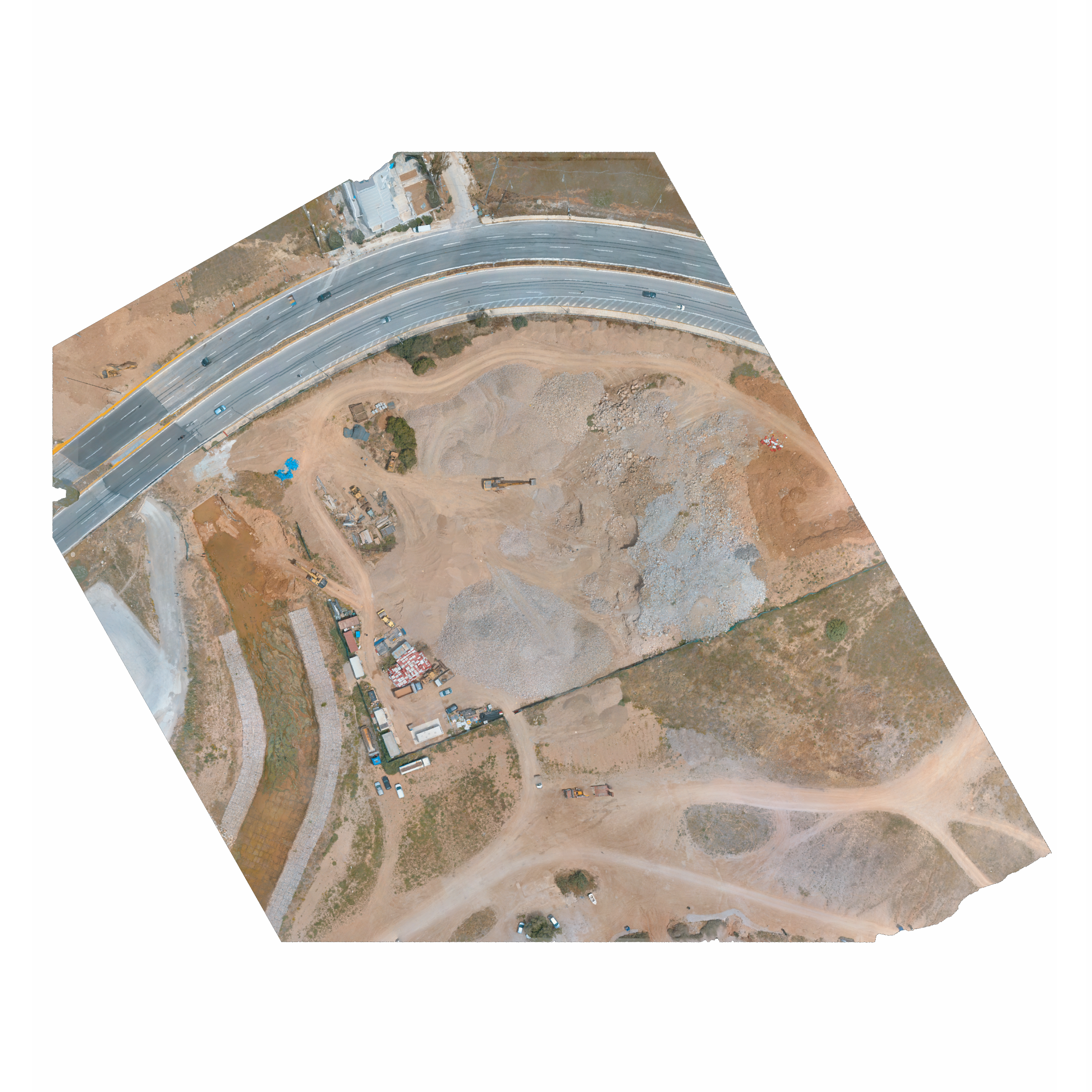
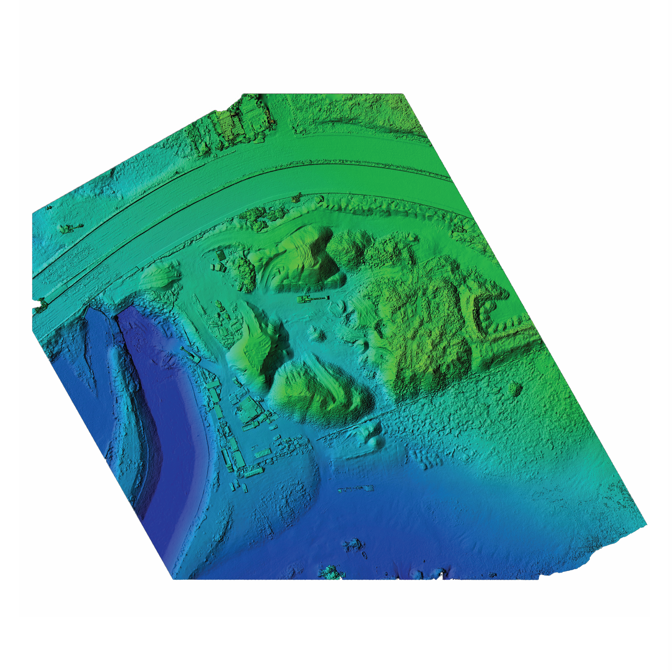
- Complete 3D mapping and volumetric measurements of materials at a construction site for the “Arrangement of Kormi Stream from the Varis – Koropiou Boulevard until the estuary” in Varkiza of the Municipality of Vari – Voula – Vouliagmeni.
- 280 views